Photos
|
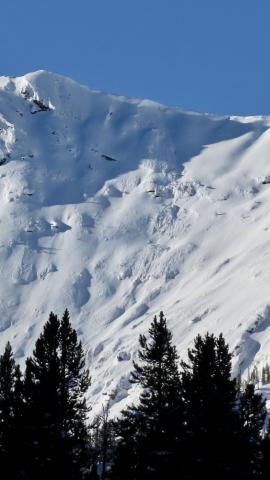
Cooke City, 2025-01-27 On Jan 27 we saw a cornice fall on a very big steep slope up Republic Creek which did not trigger anything large or deeper, but entrained some snow and ran over a thousand feet vertical. Photo: GNFAC |
|
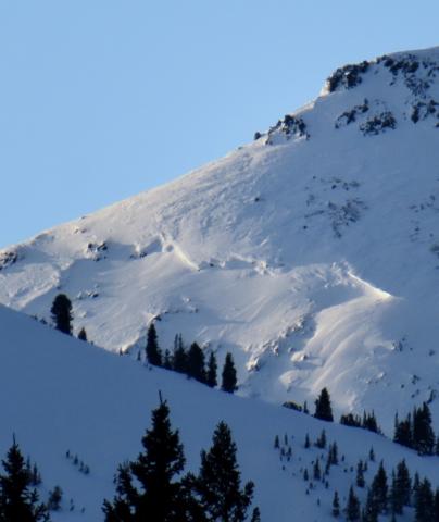
Cooke City, 2025-01-27 On Jan 27 We saw one old, but very large persistent slab avalanche further up Republic Creek (pictured). It was on similar aspect and elevation as a somewhat more recent persistent slab in nearby Hayden Creek, North-northeast, 10,000'. It appeared to be 6'+ deep and 500'+ wide. The bed surface and crown had been partially drifted in, so it seemed it was probably at least a week old...? Photo: GNFAC Link to Avalanche Details |
|
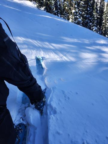
Bridger Range, 2025-01-27 In the Playground area of the Bridger Range, strong winds rapidly built wind slabs up to 25 cm deep around treeline. Skiers experienced a few cracks in this wind slab, propagating 2 or 3 meters from our ski tips. Photo: N. deLeeuw Link to Avalanche Details |
|
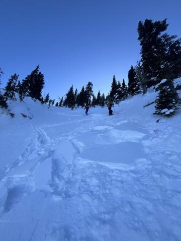
Bridger Range, 2025-01-27 Skiers triggered a small wind slab avalanche while skinning near the top of Pair Of Chutes in the Playground. The slab was about 1 foot thick, fist hardness, propagated 20 feet wide and ran 50 feet before breaking up and arresting. Photo: J. Taylor Link to Avalanche Details |
|
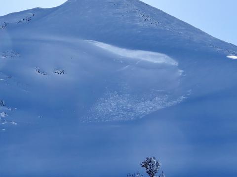
Cooke City, 2025-01-26 On January 26 we saw a handful (4-6?) of old wind slab avalanches of various ages. The most recent and largest appearing, but still not very fresh, was on the north side of Scotch Bonnet (attached photo). Most were D1-D1.5, the slide pictured was D1.5-2. Photo: GNFAC |
|
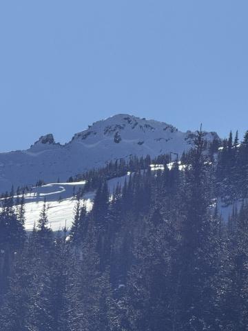
Cooke City, 2025-01-25 While touring today, we saw a deep slab avalanche at the southern end of the Hayden Creek drainage. NE aspect. It seemed to be recent, likely in the last day or so. Photo: N Mattes Link to Avalanche Details |
|
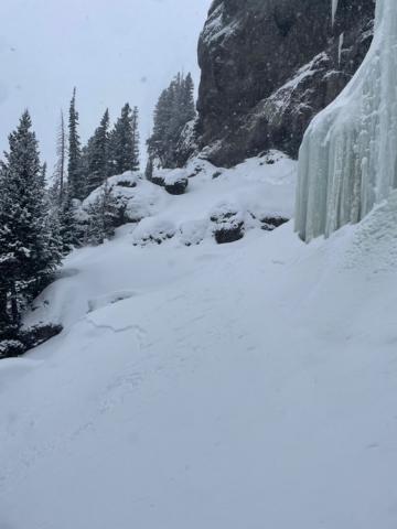
Northern Gallatin, 2025-01-24 Very touchy storm slabs formed throughout the day. 6-8” deep by 3pm. low density snow/slab but very fast moving.Photo: R Griffiths Link to Avalanche Details |
|
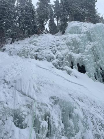
Northern Gallatin, 2025-01-24 Very touchy storm slabs formed throughout the day. 6-8” deep by 3pm. low density snow/slab but very fast moving. Photo: R Griffiths Link to Avalanche Details |
|
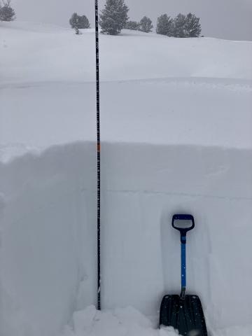
Northern Madison, 2025-01-24 Jan 24, Buck Ridge... We dug on an E facing slope at 9,400'. Snow depth was 155cm (5 feet) and we had an ECTN12 on the surface hoar layer 10" down. Photo GNFAC |
|
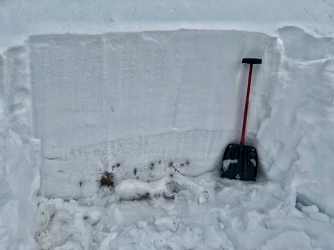
Lionhead Range, 2025-01-23 1 meter deep snowpack showing the obvious facets in the bottom third |
|
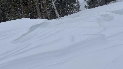
Bridger Range, 2025-01-22 Winds have worked over many slopes near the Throne. We found some slopes stripped nearly to dirt with the snow blown off to who knows where, and others had wind-sculpted sastrugi. Trees were broken off, and debris littered the snow surface. Photo: GNFAC |
|
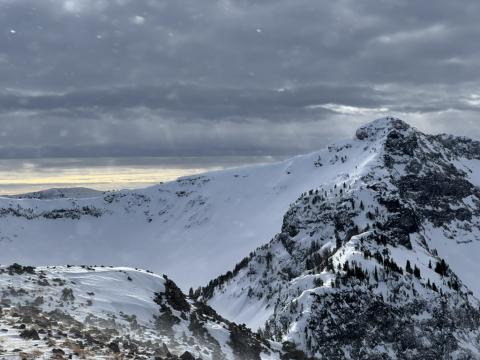
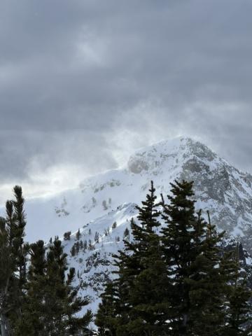
Northern Gallatin, 2025-01-22 Today, we traveled into the Maid of the Mist basin and up and along the Palace Butte ridgeline. Although temperatures have warmed up significantly since the weekend, strong winds kept conditions frigid. Winds blew plumes of snow off the high peaks and at ridgelines, gusting 50-60 mph. Photo: GNFAC |
|
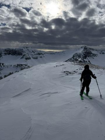
Northern Gallatin, 2025-01-22 Winds blew plumes of snow off the high peaks and at ridgelines, gusting 50-60 mph. Photo: GNFAC |
|
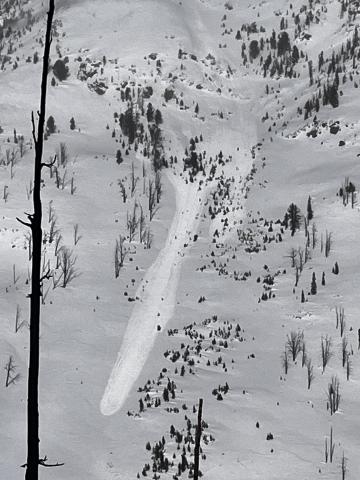
Northern Gallatin, 2025-01-22 Winds blew plumes of snow off the high peaks and at ridgelines, gusting 50-60 mph. Photo: GNFAC |
|
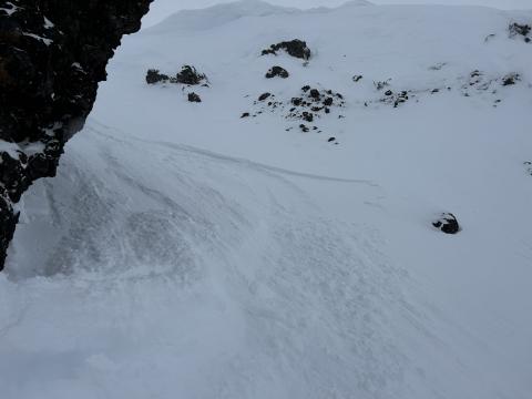
Cooke City, 2025-01-22 Wind slab avalanche on E Henderson North of the large slide path close to Fisher Pk. R1 D2,1-2' deep, 200' wide. It broke aprx 200' below the summit mid slope. It looked like it broke on the 19th. Photo: BPG Link to Avalanche Details |
|
Northern Gallatin, 2025-01-20 From Obs. "Wind was swirling in Maid of the Mist yesterday, mostly upslope winds that were transporting snow, but inconsistently and were difficult to predict where they were loading. We did not find widespread wind loading, but did get a very small windslab to release just below the top of the ridge (max 3-4" thickness, see image)." Photo: C. Avis Link to Avalanche Details |
|
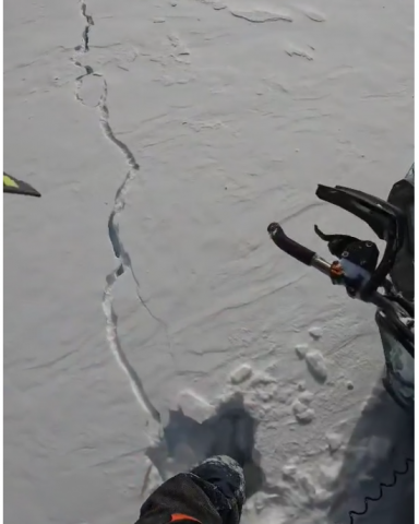
Southern Madison, 2025-01-20 From FB message 1/19: "In between redstreak peak and white peak... The whole slope cracked..." C. Fregian Screenshots from videos sent in messenger Link to Avalanche Details |
|
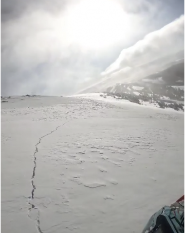
Southern Madison, 2025-01-20 From FB message 1/19: "In between redstreak peak and white peak... The whole slope cracked..." C. Fregian Link to Avalanche Details |
|
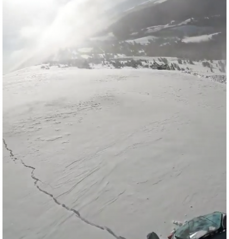
Southern Madison, 2025-01-20 From FB message 1/19: "In between redstreak peak and white peak... The whole slope cracked..." C. Fregian Screenshots from videos sent in messenger Link to Avalanche Details |
|
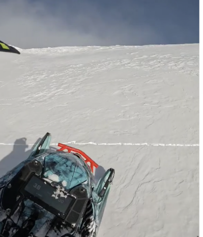
Southern Madison, 2025-01-20 From FB message 1/19: "In between redstreak peak and white peak... The whole slope cracked…" Screenshots from videos sent in messenger Link to Avalanche Details |
