Photos
|
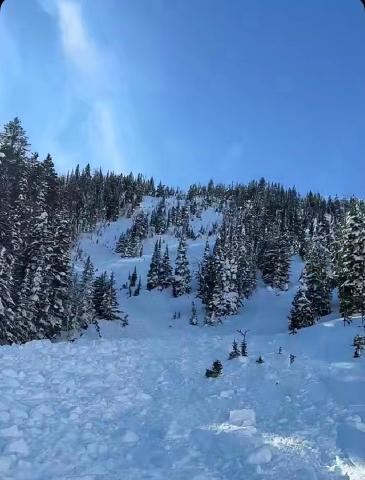
Southern Madison, 2025-02-28 From IG message: "Getting word that a group triggered a decent slide today out at cabin creek. I’ll attach the coordinates to the general area, to the best of my knowledge. No burials. They were able to outride if. But thought I’d send coordinates in case you guys were gonna be in the area and wanted to check it out." Link to Avalanche Details |
|
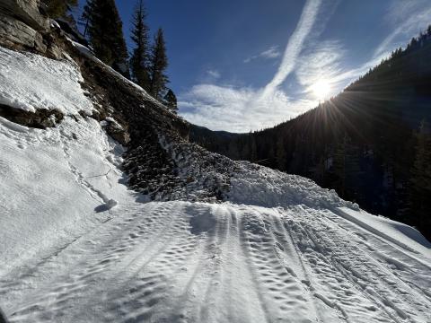
Northern Gallatin, 2025-02-27 This older wet slide is a good example of what to look out for especially at low elevations. |
|
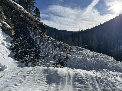
Northern Gallatin, 2025-02-27 This older wet slide is a good example of what to look out for especially at low elevations. |
|
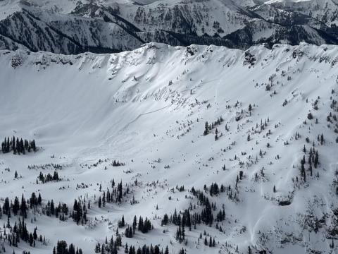
Northern Gallatin, 2025-02-27 Cornice release above the headwaters of storm castle creek which triggered a slab, east facing aspect. Looked to be several feet deep and ran a long way.
Link to Avalanche Details |

|
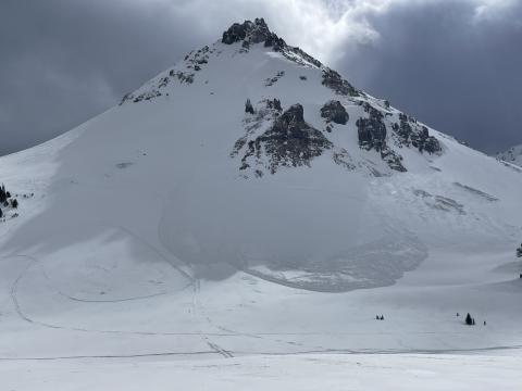
Northern Gallatin, 2025-02-27 |
|
Cooke City, 2025-02-25 Fresh wind slab avalanche seen this afternoon, possibly rider triggered. Photo: N. Meyers Link to Avalanche Details |

|
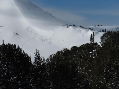
Northern Gallatin, 2025-02-25 Total snow depth on a NE aspect was 230 cm (7.5 ft). Right side up and strong. Dust layer from Feb 4th was 70 cm deep (28 inches) with no facets under it. |
|
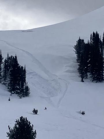
Cooke City, 2025-02-24 On Feb 24 we saw at least 3 rider triggered wind slabs, 4-5 natural wind slab avalanches, and a couple large cornice falls. Strong wid had affected almost every piece of terrain, scouring some slopes, loading others, just stiffening the slab in many areas, and forming fresh drifts on every convex roll and along the edges of trails. Riding was still soft and fairly consistent in many areas. Photo GNFAC Link to Avalanche Details |
|
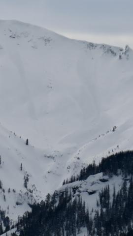
Cooke City, 2025-02-24 On Feb 24 we saw at least 3 rider triggered wind slabs, 4-5 natural wind slab avalanches, and a couple large cornice falls. Strong wid had affected almost every piece of terrain, scouring some slopes, loading others, just stiffening the slab in many areas, and forming fresh drifts on every convex roll and along the edges of trails. Riding was still soft and fairly consistent in many areas. Photo GNFAC |
|
Cooke City, 2025-02-24 On Feb 24 we saw at least 3 rider triggered wind slabs, 4-5 natural wind slab avalanches, and a couple large cornice falls. Strong wid had affected almost every piece of terrain, scouring some slopes, loading others, just stiffening the slab in many areas, and forming fresh drifts on every convex roll and along the edges of trails. Riding was still soft and fairly consistent in many areas. Photo GNFAC Link to Avalanche Details |
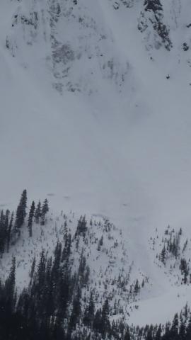
|
Cooke City, 2025-02-24 On Feb 24 we saw at least 3 rider triggered wind slabs, 4-5 natural wind slab avalanches, and a couple large cornice falls. Strong wid had affected almost every piece of terrain, scouring some slopes, loading others, just stiffening the slab in many areas, and forming fresh drifts on every convex roll and along the edges of trails. Riding was still soft and fairly consistent in many areas. Photo GNFAC Link to Avalanche Details |
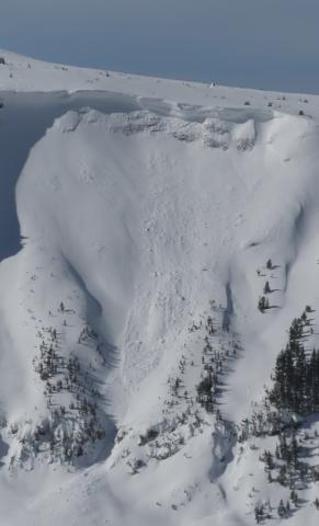
|
Cooke City, 2025-02-24 On Feb 24 we saw at least 3 rider triggered wind slabs, 4-5 natural wind slab avalanches, and a couple large cornice falls. Strong wid had affected almost every piece of terrain, scouring some slopes, loading others, just stiffening the slab in many areas, and forming fresh drifts on every convex roll and along the edges of trails. Riding was still soft and fairly consistent in many areas. Photo GNFAC Link to Avalanche Details |
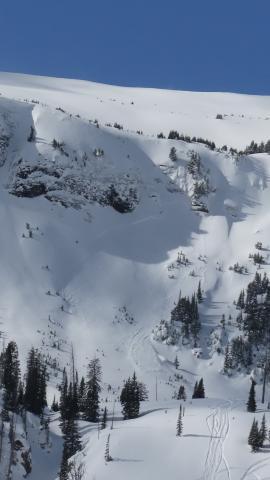
|
Cooke City, 2025-02-24 On Feb 24 we saw at least 3 rider triggered wind slabs, 4-5 natural wind slab avalanches, and a couple large cornice falls. Strong wid had affected almost every piece of terrain, scouring some slopes, loading others, just stiffening the slab in many areas, and forming fresh drifts on every convex roll and along the edges of trails. Riding was still soft and fairly consistent in many areas. Photo GNFAC Link to Avalanche Details |

|
Cooke City, 2025-02-24 While looking for a recent avalanche from the flat bench above we triggered a similar sized slide directly adjacent to the previous slide. They broke on weak layers of facets and surface hoar that formed at the end of January. 2-3 feet deep and 150-200' wide. Photo: GNFAC Link to Avalanche Details |
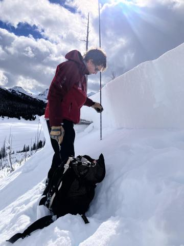
|
Cooke City, 2025-02-24 While looking for a recent avalanche from the flat bench above we triggered a similar sized slide directly adjacent to the previous slide. They broke on weak layers of facets and surface hoar that formed at the end of January. 2-3 feet deep and 150-200' wide. Observing the snowpack that caused the avalanche. Photo: GNFAC Link to Avalanche Details |

|
Cooke City, 2025-02-24 While looking for a recent avalanche from the flat bench above we triggered a similar sized slide directly adjacent to the previous slide. They broke on weak layers of facets and surface hoar that formed at the end of January. 2-3 feet deep and 150-200' wide. Photo: GNFAC Link to Avalanche Details |

|
Cooke City, 2025-02-24 While looking for a recent avalanche from the flat bench above we triggered a similar sized slide directly adjacent to the previous slide. They broke on weak layers of facets and surface hoar that formed at the end of January. 2-3 feet deep and 150-200' wide. Photo: GNFAC Link to Avalanche Details |
|
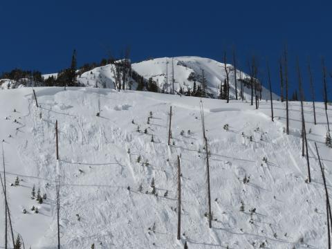
Cooke City, 2025-02-24 While looking for a recent avalanche from the flat bench above we triggered a similar sized slide directly adjacent to the previous slide. They broke on weak layers of facets and surface hoar that formed at the end of January. 2-3 feet deep and 150-200' wide. Photo: GNFAC Link to Avalanche Details |
|
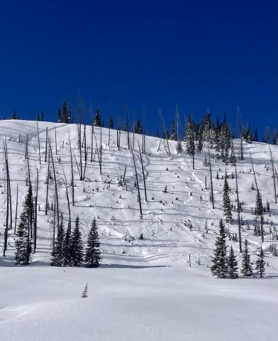
Cooke City, 2025-02-24 An avalanche that was triggered two days ago (Feb 22), remotely from flat terrain above a steep slope, on the northeast end of Mt. Abundance. Photo: GNFAC Link to Avalanche Details |

|
Northern Gallatin, 2025-02-24 Clean up on aisle hyalite! Couple small wet slides between the retaining wall and practice rock, big enough to reduce the road to one lane. Photo: K. Marvinney Link to Avalanche Details |
